


The Eratosthenes Centre of Excellence at the Cyprus University of Technology (CUT) has proceeded with a new, final, and more accurate mapping of the burnt area in the Limassol district.
In its previous announcements, it said that the estimated burnt area ranged between 120.7 and 124 square kilometers, based on satellite images of different resolutions (initially 300 m, later 3 m). In the new mapping, the analysis was based on very high-resolution WorldView Legion Ortho-ready Bundle satellite images (30 cm), which offer exceptional detail.
The WorldView Legion image, delivered by GEOSERVE NL on 28 July, 2025, "is completely cloud- and smoke-free, allowing for more precise calculations of the burnt area—even at the level of individual buildings," it said.
For the analysis of the new image, the GTFire tool was used. GTFire is a pioneering forest fire monitoring tool that combines real-time satellite data with predictive models. The burnt area was re-estimated at 104 sq. km. However, with the application of spatial gap-filling techniques, the estimate approximates the initial rough assessments.
According to the Centre's final analysis:
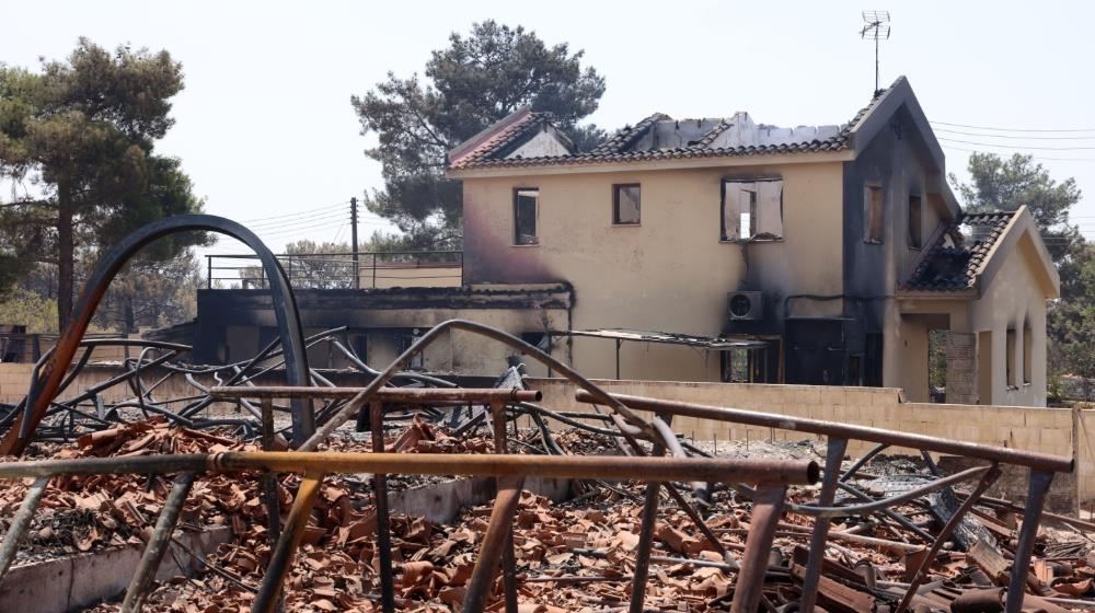
"According to the latest analysis by the ERATOSTHENES Centre of Excellence, the devastating wildfire that broke out in the Limassol district on 23 July 2025 is estimated to have burned a total of 120.7 km². Taking into account that the total area of Cyprus is 9,251 km², the burned area corresponds to approximately 1.3% of the island’s surface, a particularly significant percentage considering that it resulted from a single wildfire. This loss affects not only the region’s biodiversity and natural heritage but also local communities and ecosystems, which will require decades to recover.
The estimate is based on high‑resolution (3 m) satellite data from the PlanetScope constellation, acquired on 26 July 2025 at 09:00 (UTC).
Also, according to data from the WorldCover program of the European Space Agency (ESA), of the total burned area:
-approximately 51% consists of grasslands,
-31% shrubland,
-15.5% forested areas,
-while 1.1% corresponds to residential areas.
In addition, about 21% of the burned area falls within the Natura 2000 network, affecting important protected sites such as the Paramaliou River, the Cha‑Potami Special Protection Area, and the Limmati Valley Special Protection Area."
(Sources: CNA, Eratosthenes Centre of Excellence)